![]()
Advancing research with cutting-edge technology to perceive and measure the world, validating change for communities, industry, and the environment.
The UQ Drones Collaborative Research Platform is a leading hub for drone-based research and innovation, providing researchers, industry partners, and government agencies with access to cutting-edge remote sensing technology and expertise.
With a vast library of drones, advanced remote sensing capabilities, and a fully equipped workshop, we can provide custom builds and specialised payload integration. The platform supports diverse research fields, including environmental science, geophysics and agriculture, ensuring efficient and safe operations. A multidisciplinary team of experts provides piloting, data analysis and project management, helping researchers and industry partners achieve groundbreaking results with streamlined workflows.
Researchers
The UQ Drones Collaborative Research Platform helps researchers by providing and developing custom drone technology. With a library of advanced drones, specialized remote sensing payloads, and a fully equipped workshop, researchers can conduct direct sampling, environmental monitoring, and geospatial studies with precision. Whether you need a drone to collect and analyse bush fire smoke samples for a health study, map the environment or survey an ancient indigenous archaeological site, we can provide a solution.
Industry
The UQ Drones Collaborative Research Platform supports industry by delivering advanced drone solutions to solve real-world challenges. With access to strictly maintained drones, specialized payloads, and expert consultation, businesses can enhance operations in mining, agriculture, geophysics, environmental monitoring and more. Our team consists of industry experienced pilots and field technicians who know exactly what it takes to meet the demands of your business. We are fully CASA compliant and conform to Quality Assurance and Quality Control standards.
HySpex Mjolnir VS-620
Comprehensive Spectral Coverage
Full VNIR-SWIR range: 400 – 2500 nm
490 spectral bands with 5.1 nm sampling resolution
Ideal for precise material identification and classification
Superior Data Quality
Keystone and smile distortion <0.1 pixels for sharp, geometrically accurate imagery
Peak signal-to-noise ratio (SNR) >900 for high-fidelity spectral data
UAV-Optimized Design
Lightweight (6 kg) and compact for efficient aerial deployment
Co-aligned VNIR and SWIR optical axes for perfect coregistration in flight direction
High-Speed Data Acquisition
Frame rate up to 100 fps for rapid survey coverage
16-bit raw data resolution for enhanced dynamic range and detail
Applications
Mineral Exploration – Spectral mapping of surface mineralogy
Agriculture & Forestry – Crop health, vegetation stress, and biodiversity analysis
Environmental Monitoring – Pollution detection, water quality assessment, and land change analysis
Geological & Infrastructure Surveys – Terrain classification and material inspection
By leveraging the HySpex VS-620, we deliver high-resolution hyperspectral datasets tailored for scientific research, environmental sustainability, and industrial applications.
RIEGL VQ-840-GE
High-Precision Subsurface Mapping
Echo digitization and online waveform processing for detailed elevation data
Accurate measurement of both terrestrial and underwater topography
Efficient Data Acquisition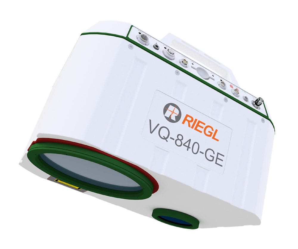
Laser pulse repetition rate up to 100 kHz
Scanning speeds up to 100 lines per second
High spatial resolution for dense 3D point clouds
Integrated Positioning & Imaging
Advanced GNSS/IMU integration for precise geolocation
Optional high-resolution aerial imaging for enhanced context and analysis
Applications
Coastal & Shallow Water Mapping – Shoreline delineation and bathymetric profiling
River & Stream Surveys – Channel morphology and sediment transport studies
Reservoir & Wetland Monitoring – Water body volume estimation and habitat assessment
Infrastructure Planning – Bridge, dam, and levee inspections
By combining high-resolution LiDAR technology with robust positioning and imaging systems, we deliver reliable bathymetric datasets tailored for environmental research, engineering design, and resource management.
RIEGL VUX-120
High-Speed, High-Density Data Collection
Laser pulse repetition rate up to 2.4 MHz
Measurement rates up to 2,000,000 points per second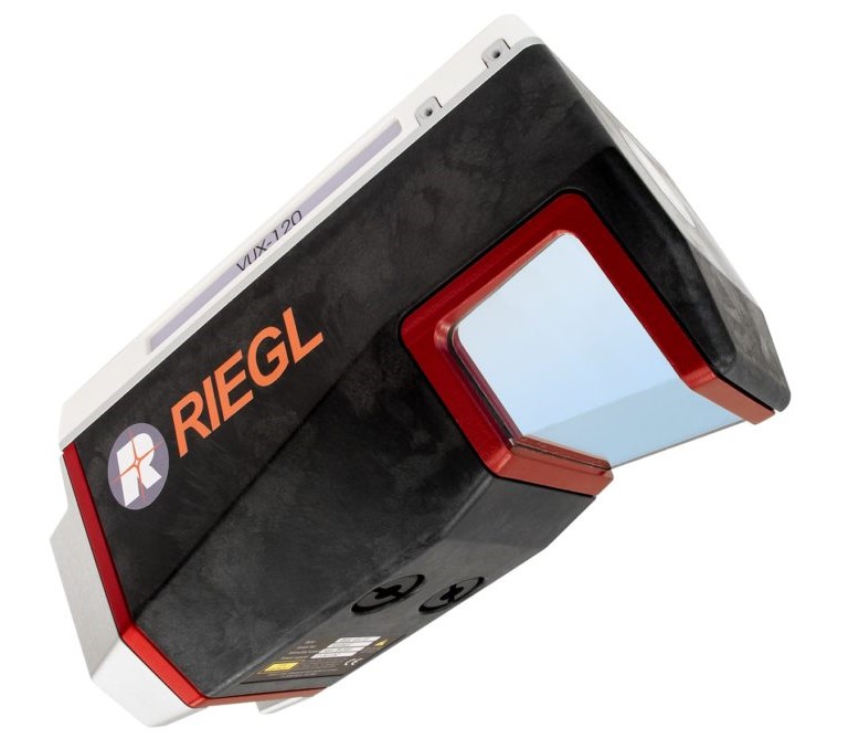
Ideal for capturing fine-scale terrain and structural detail
Advanced Scanning Geometry
NFB scanning pattern for enhanced coverage and minimal shadowing
100° field of view for wide-area mapping
Precision Mapping Capabilities
Accurate elevation and surface modeling in rugged terrain
Reliable performance in urban, forested, and canyon-like environments
Applications
Mining & Topographic Surveys – Detailed terrain modeling and volumetric analysis
Urban & Environmental Monitoring – Infrastructure mapping and change detection
Forestry & Agriculture – Canopy structure, biomass estimation, and land-use classification
Archaeology & Cultural Heritage – Site documentation and landscape reconstruction
Corridor Mapping – Power lines, railways, roads, and pipeline inspections
By leveraging the RIEGL VUX-120, we deliver high-resolution 3D LiDAR data tailored for scientific research, environmental management, and infrastructure development.
Elitescan W50
Lightweight & UAV-Optimized
Total system weight of just 1.4 kg (including 26MP camera)
Compatible with DJI M300/M350, multirotor, and fixed-wing platforms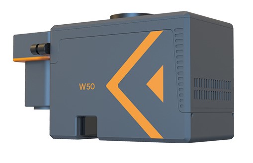
Quick-release interface for rapid deployment
Long-Range & High-Efficiency Scanning
Operating flight height up to 450 m
Measurement range up to 1000 m (80% reflectivity)
Scanning speed up to 300 lines/sec with point frequencies up to 1 MHz
Exceptional Ground Penetration
Up to 7 echo returns for reliable ground point acquisition through vegetation
90° field of view for wide-area coverage
High-Precision Geospatial Data
System accuracy: 5 cm (plane) / 3 cm (elevation) @150 m
Post-processed positioning accuracy: 1 cm (plane) / 2 cm (elevation)
Attitude accuracy: Heading 0.04°, Pitch/Roll 0.008°
Integrated Imaging Capabilities
26MP RGB camera
Image resolutions up to 8192×5468 with FoV up to 90°
Ground Sampling Distance (GSD): ~2.1–2.3 cm @100 m flight height
Applications
Forestry & Vegetation Mapping – Penetrate canopy to model terrain and biomass
Topographic & Terrain Surveys – High-resolution elevation models
Infrastructure & Corridor Mapping – Power lines, roads, and pipelines
Environmental Monitoring – Floodplain analysis, erosion studies, and habitat mapping
By leveraging the Elitescan W50, we deliver high-density, precision LiDAR data tailored for scientific research, environmental management, and infrastructure development.
Ceasium Vapour CS-VL Magnetometer
Ultra-Sensitive Magnetic Detection
Sensitivity: 0.0006 nT/√Hz rms
Absolute accuracy: <2.5 nT
Enables detailed mapping of subtle magnetic anomalies
Broad Measurement Range
Operates across 15,000 to 105,000 nT
Suitable for diverse geological, environmental, and archaeological applications
Advanced Data Processing & Interpretation
Specialized software for magnetic data processing and visualization
Delivers clear, actionable insights for exploration and analysis
Applications
Mineral Exploration – Detect subsurface mineral deposits and structures
Geological Mapping – Characterize lithology and structural features
Environmental & Archaeological Surveys – Identify buried features and contamination zones
By integrating high-sensitivity magnetometry with robust airborne platforms and expert data analysis, we provide comprehensive geophysical datasets to support research, resource development, and environmental monitoring.
Sony ILX-LR1 Sextuple Lens
High-Resolution Data Collection
61MP RGB mapping for highly detailed aerial imagery
14-band multispectral imaging (7MP per band) or 13 bands + wide RGB for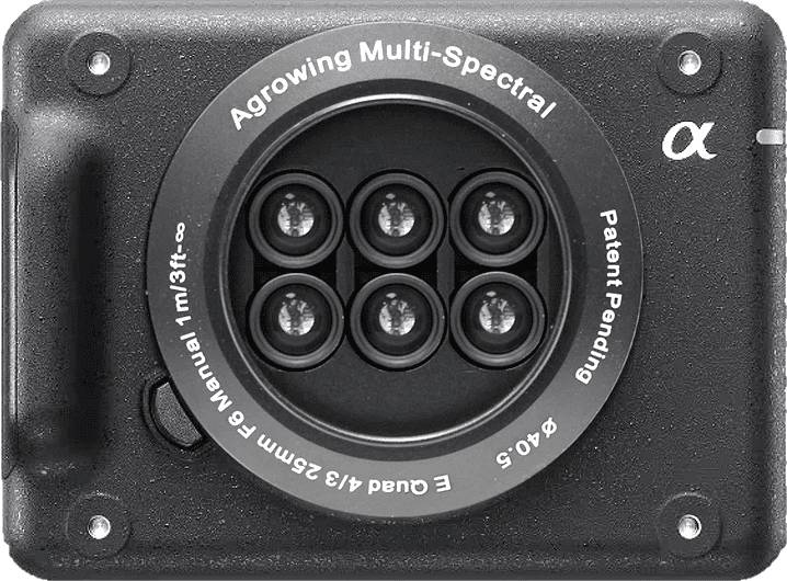 comprehensive spectral analysis
Precision-Tuned Spectral Bands
30nm wide spectral bands: 405, 430, 450, 490, 525, 550, 560, 570, 630, 650, 685, 710, 735, 850 nm
Optimized for vegetation analysis, environmental monitoring, and land-use studies
Lightweight & UAV-Optimized
Compact full-frame E-Mount system (424g total weight)
Designed for seamless UAV integration, enabling high-efficiency aerial surveys
Advanced Lens System
Sextuple single mount lens for precise spectral separation
21.8mm effective focal length, f/5.6 aperture, and low distortion (<2%) for superior image quality
Applications
Precision Agriculture – Crop health monitoring, vegetation stress analysis
Environmental Studies – Land cover classification, ecosystem monitoring
Infrastructure & Urban Planning – Remote sensing of built environments
Forestry & Conservation – Biomass estimation, habitat analysis
By leveraging the ILX-LR1 Sextuple Lens, we provide high-accuracy multispectral data tailored for scientific research, industry applications, and environmental sustainability initiatives.
Medusa MS-2000
Robust & Field-Ready Design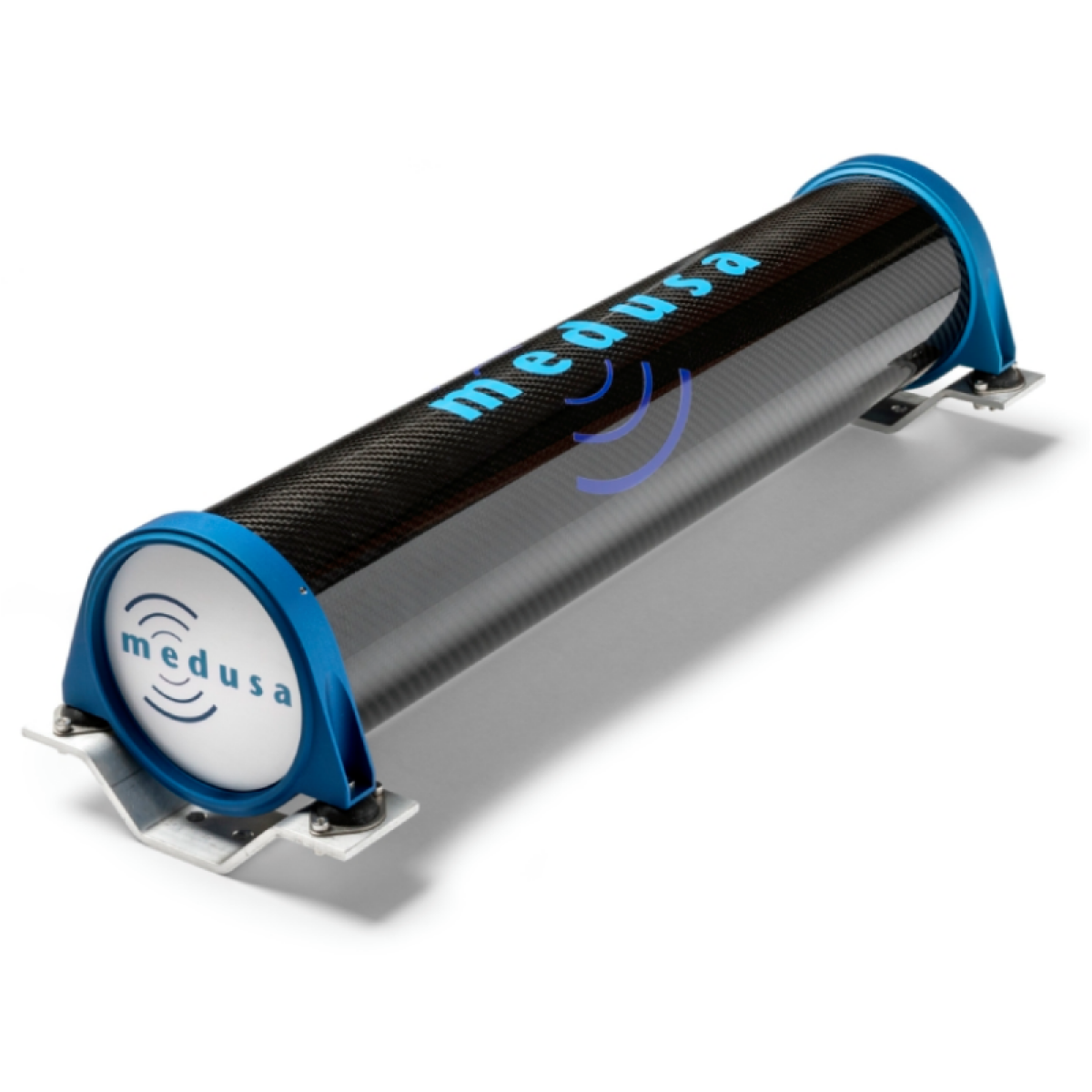
Kevlar-reinforced carbon fiber housing with vibration-dampening mount
IP65-rated for operation in harsh environments
Operates across a wide temperature range: –20 to +65 °C
High-Performance Spectrometry
2000 ml CsI scintillator crystal for sensitive gamma-ray detection
Real-time radionuclide analysis of ^40K, ^238U, ^232Th, and ^137Cs
Mapping speeds up to 45 km/h with 5 Hz recording frequency
Applications
Soil and sediment scanning
NORM (Naturally Occurring Radioactive Material) characterization
Contamination mapping and environmental monitoring
Ground-based radiometric surveys using vehicles or UAVs
By deploying the Medusa MS-2000, we deliver accurate, efficient, and scalable gamma-ray data tailored to scientific research, environmental assessments, and industrial safety operations.
ARACE Angel
Max Payload: 1.9kg
Maximum Take-Off Weight: 6kg
Arace Pheonix

Max Payload: 2kg
Maximum Take-Off Weight: 12.5kg
Callisto 50

Max Payload: 26kg
Maximum Take-Off Weight: 52kg
Acecore NOA

Max Payload: 20kg
Maximum Take-Off Weight: 36.9kg
DJI Mavic 3M
Maximum Take-Off Weight: 1.05kg
Bathymetric LiDAR Surveys with RIEGL VQ-840-GE
Our bathymetric LiDAR services utilize the RIEGL VQ-840-GE, a state-of-the-art airborne laser scanner designed for simultaneous topographic and bathymetric mapping. Using a narrow green laser beam (532 nm), this system penetrates water surfaces to accurately measure submerged terrain—ideal for coastal, riverine, and reservoir environments.
Hyperspectral Imaging Surveys with HySpex Mjolnir VS-620
Our hyperspectral imaging services utilize the HySpex Mjolnir VS-620, a high-performance, co-aligned VNIR-SWIR sensor designed for scientific-grade remote sensing. With 490 spectral bands and exceptional coregistration accuracy, this system delivers detailed spectral data across a wide range of applications—from mineral exploration to environmental monitoring.
LiDAR with Elitescan W50
Our airborne LiDAR services utilize the Elitescan W50, a compact and highly integrated system developed by EPiC LiDAR. Combining a high-performance laser scanner, IMU, and RGB camera (colourisation), the W50 delivers exceptional range, precision, and vegetation penetration—making it ideal for complex terrain and dense canopy environments.
Airborne Geophysical Surveys – Magnetics, EM & Gravity
Our airborne geophysical survey services offer high-resolution magnetic data acquisition using advanced instrumentation tailored for precision and reliability. Central to our magnetic survey capability is the Scintrex CS-VL Cesium Vapor Magnetometer, a state-of-the-art sensor designed for sensitive and accurate total magnetic field measurements.
Gamma-Ray Surveys with Medusa MS-2000
Our gamma-ray spectrometry services utilize the Medusa MS-2000, a rugged sensor designed for high-efficiency radiometric mapping. Engineered for autonomous operation and real-time data processing, the MS-2000 is ideal for environmental, geological, and industrial applications requiring precise radionuclide detection.
Topographic LiDAR Surveys with RIEGL VUX-120
Our topographic LiDAR services utilize the RIEGL VUX-120, a high-performance UAV LiDAR sensor engineered for precision and high-density aerial mapping. Featuring a 100° field of view and a unique Nadir/Forward/Backward (NFB) scanning pattern, the VUX-120 ensures exceptional data completeness—even in complex environments with vertical structures, dense vegetation, or narrow corridors.
Multispectral/Photogrammetry Surveys with Sony ILX-LR1 Sextuple/Quad Lens
Our multispectral imaging surveys utilize the Sony ILX-LR1 Sextuple/Quad Lens, a cutting-edge dual-purpose mapping solution optimized for drone-based research applications. This lightweight yet powerful system delivers high-resolution RGB mapping and advanced multispectral/photogrammetry data acquisition for a wide range of scientific and environmental studies.
For more information regarding flying drones on campus follow this link
Contact us
Get in touch with our team today to get your next project off the ground.
Email: drones@uq.edu.au
Location: St Lucia Campus, Brisbane